- Login
- |
- |
- |
- |
Fire Hazard Severity Zone Map
Posted on 07/25/2026
🔥 Is your property in Studio City in a Fire Hazard Severity Zone?
Stay informed and prepared! Check out California's updated Fire Hazard Severity Zone (FHSZ) Map to view the wildfire hazard designation for your property and community.
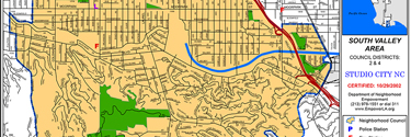
- Southern Studio City (South of Ventura Blvd / Foothills): A significant portion of southern Studio City—especially the hilly neighborhoods extending into the Santa Monica Mountains—falls within the LAFD Very High Fire Hazard Severity Zone (VHFHSZ).
- Flat/Northern Studio City: Lower-lying areas near the valley floor are typically classified under lower hazard levels or local responsibility zones.
Tip: You can plug your specific Studio City address into the ArcGIS Map Link to check whether your property sits inside the Very High Fire Hazard Severity Zone boundary!
Knowing your zone helps you take the right steps toward defensible space, home hardening, and emergency readiness. 🏠🌲
#FireSafety #WildfirePreparedness #California #FHSZ #CommunitySafety #DefensibleSpace